The area that would become Yarmouth is in the homeland of the Abenaki Nation, part of the Wabanaki Confederacy, and has long been valued by Wabanaki communities for the natural features that define the coastal land, with its easy access to the rich resources and opportunities offered by both river and ocean. This location and its attributes quickly became sources of conflict as European colonists began to arrive in the 17th century, bringing with them conventions about land use, ownership, and trade that contrasted sharply with long-standing Wabanaki systems of stewardship and reciprocity.
Following years of successive Anglo-Wabanaki wars and the decimation of indigenous populations by diseases introduced by the colonists, settlers established the town that would become Yarmouth around 1715. The area had been named North Yarmouth by colonists in 1680 to differentiate it from Yarmouth, Massachusetts (Maine was part of Massachusetts until it gained statehood in 1820). The territory of “ancient” North Yarmouth was large and contained a number of present-day towns that gradually split off: Harpswell was set off in 1758, Freeport in 1789, Pownal in 1808, Cumberland in 1821, and Yarmouth in 1849, leaving today’s North Yarmouth as the bearer of the name.
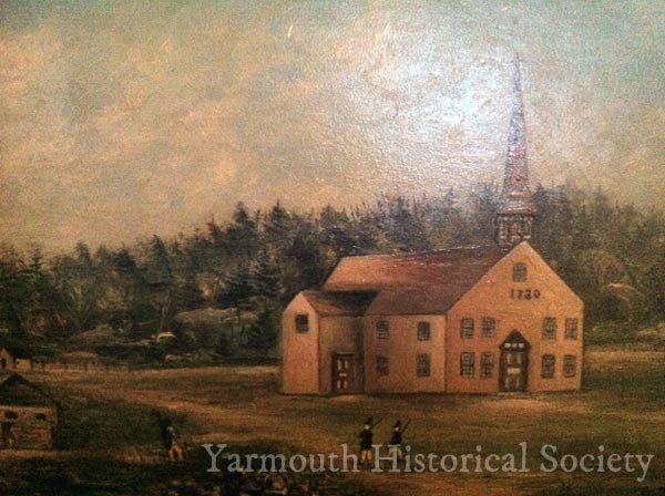
By 1722, the population of settlers was close to 100 people. The Old Meeting House Under the Ledge was built in 1729 to serve as the church and town house. The settlement also had a school, tavern and a cemetery, but was fined for not having stocks and a dunking pool.
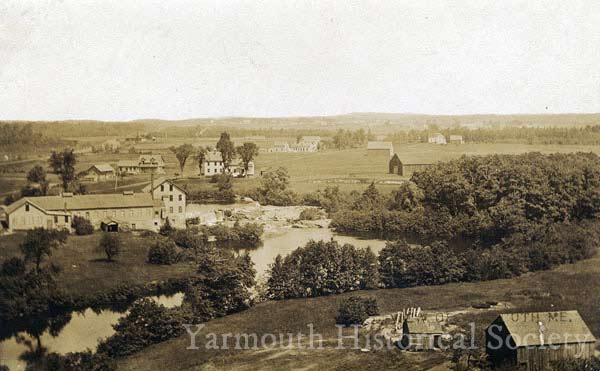
Between 1715 and 1810, North Yarmouth’s population grew rapidly. As the town expanded, it started to take on the shape and geography that is still familiar to us today in the present village, with its two distinct centers. Falls Village, the area near the harbor, was the location of Union Wharf, North Yarmouth Academy and the Second Congregational Church (“Old Sloop”), which was constructed in 1818. A great focus in this area was the harbor and its shipbuilding activities. Corner Village, later Yarmouthville, was the location of the Meeting House on the Hill and a variety of shop, merchants, and, later, mills.